

Moderate to Hard • Incredible Lake Superior views
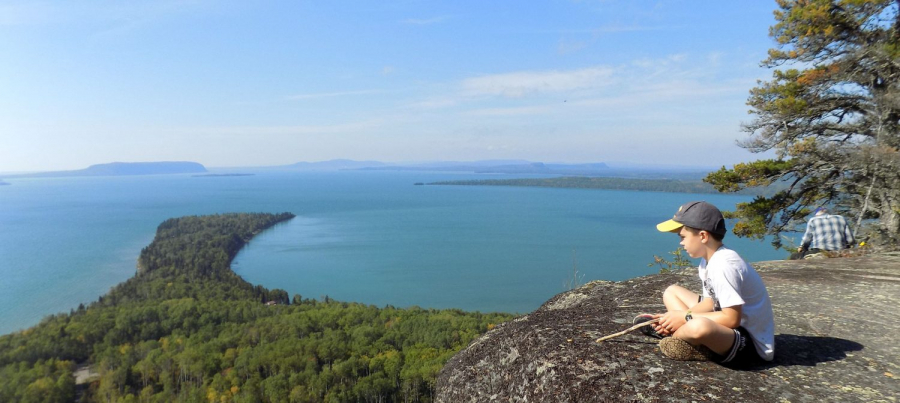
Located 25 km (15.5 mi) east of Nipigon, the Kama Cliffs Trail is a 7.3 km (4.5 mi) loop that offers one of the most breathtaking viewpoints along the North Shore. This multi-use, non-motorized trail is mostly moderate, but one steep ascent earns it a moderate-to-hard rating. The climb is well worth it—once you reach the top, you’re treated to sweeping, panoramic views of Nipigon Bay, its islands, and the vast blue horizon of Lake Superior.
Give yourself time at the summit to rest, take photos, and soak in the incredible scenery before completing the loop.
Trail Access:
From Nipigon, travel 25 km (15.5 mi) east on Highway 17. About 0.5 km before the Jackpine River Bridge, turn onto Kama Bay Road and park in the designated lot. From there, carefully cross the highway to find the trailhead sign.
Trail Maintenance:
This trail is cared for by the Singletrack Society, whose volunteers help keep this rugged, scenic route accessible for all who love to explore.
Read more about the Kama Cliffs Trail in the Exploring the Edge blog.