

Challenging • 1.5–2 hrs • Waterfalls, Old-Growth Cedars & “Enchanted Forest”
Click Here for the Trail Map 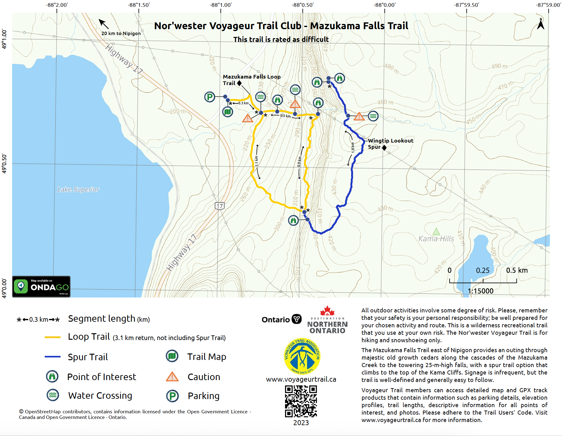 Mazukama Falls Trail Map (VTA-2023)
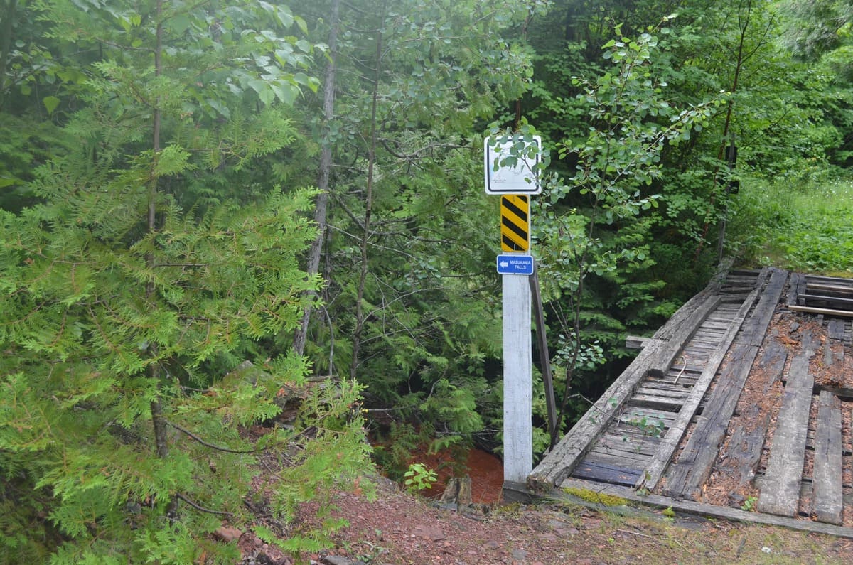
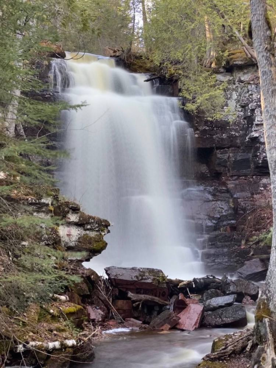
The Mazukama Falls Loop is often described as magical—a challenging day hike filled with dramatic scenery and unforgettable natural features. This rugged loop takes 1.5–2 hours to complete and begins with a steep 500 m climb alongside the cascades and waterfalls of Mazukama Creek. The trail winds through towering old-growth cedars as the creek tumbles down the red rocks of the Kama Cliffs.
At the top of the ascent, hikers reach the breathtaking Mazukama Falls, a 25 m waterfall surrounded by mossy boulders and cool forest shade. From here, the trail follows the base of the cliffs, weaving past massive fern-draped rocks before descending into the dark, peaceful “Enchanted Forest”—a grove of ancient cedars and Canada yew that gives the trail its signature atmosphere.
Wingtip Lookout (Optional Spur)
For a panoramic view of Nipigon Bay, adventurous hikers can continue up the steep “Stairway of the Saints” to the top of the Kama Cliffs and onward to Wingtip Lookout, perched 250 m above the trailhead. Allow an additional 2 hours for this steep and rewarding spur trail.
Trail Difficulty
This is a wilderness recreation trail and is recommended only for experienced hikers. Expect unstable footing, steep sections, and creek crossings that may require wading. Proper footwear, water, and preparation are essential.
Read more about the Mazukama Falls Trail in the Exploring the Edge blog.